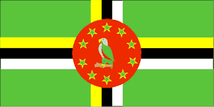
Country Guide • Dominica

Dominica was the last of the Caribbean islands to be colonized by Europeans, due chiefly to the fierce resistance of the native Caribs. Dominica is an island located at the northern end of the windward chain of the Lesser Antilles in the Caribbean Sea. It is situated between the French island groups of Guadeloupe to the north and Martinique to the south. The island is almost rectangular in shape and has a deeply indented coast line. It is of volcanic origin with many fumaroles and sulfur springs.
| Official Name | Commonwealth of Dominica |
|---|---|
| Area | 754km² (291mile²) |
| Population | 70,000 |
| Continent | Caribbean/North America |
| Population per mile² | 239 |
| Capital City | Roseau |
| Religions | Roman Catholic 77%, Methodist 5%, Pentecostal 3%, Baptist 2%, Seventh Day Adventist 2%, and other 7% |
| Language | English (official) and French patois |
| Government | Independent state within the British Commonwealth |
| Currency | East Caribbean Dollar |
| GDP | $380 million |
| GDP per Head | $5,400 |
| Natural Resources | Hydro Power and Timber |
| Land Use | Arable Land 4% |
| Agriculture | Bananas, citrus fruits, mangoes, root crops, coconuts, cocoa, lumber and fish |
| Industry | Agriculture (primarily bananas and coconuts and coconut oil), cement blocks, lumber including furniture, shoes and tourism |
| Tourism | Dominica is generally rural and unspoiled. It doesn't quite have those white beaches its fellow Caribbean countries have but instead it has a mountainous interior with hot springs, lakes, waterfalls and rainforests. Hiking is the best way to see this most Natural Island |
| Natural Hazards | Flash floods are a constant threat; destructive hurricanes can be expected during the late summer months |
| Health Risks | Sunburn, diarrhoea and intestinal parasites, leptospirosis can be present in freshwater streams so do be aware when venturing inland |
| Climate | Dominica has a tropical climate with extreme humidity and temperatures which are lessened by sea breezes. There is a vast dry season on the west side of the island and a hurricane season between July and September while the wet season is usually between June and October. Average annual rainfall varies from 69 inches on the coast to 246 inches in the central mountainous area. The average temperature ranges are from 20 to 29°C in January to 23 to 32°C in June |
| Time | GMT/UTC-4 hours |
| National Days | November 3 |
| Visas | All visitors require a round trip or onward ticket before entry. A visa is not required unless a citizen of former Eatern Bloc countries. US and Canadian citizens can enter with just proof of citizenship, such as a photo ID and an official birth certificate. French nationals may visit for up to two weeks with a Carte d'Indentité |
| British Embassy | Embassy Details |
Information Only
The content above is for information purposes only and we have tried to ensure that the information is as accurate as possible. We cannot accept any responsibility for any inconvenience, loss or injury as a result of the information above. You should always check and verify any critical information like visas, health and safety and customs with the relevant authorities before you travel since information can change at any time.


